

Subdivision Survey Steps Before One Large Parcel Becomes Several Building Lots
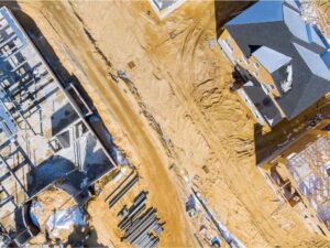
One large parcel does not turn into several building lots overnight. Before a single lot line gets recorded, a subdivision survey works through a series of steps. These confirm the land can actually be split the way a developer or owner wants.
Skipping or rushing these steps causes problems later. This usually happens right when a project is closest to approval or sale. Knowing the process ahead of time helps property owners and developers avoid delays that could have been caught early.
Here is what typically happens between owning one parcel and creating several legal building lots.
Verify the Parent Parcel Before Subdivision Planning
Every subdivision starts with the parent parcel. This is the original piece of land before it gets divided. Before any planning begins, a surveyor confirms this parcel’s boundaries using recorded deeds, past surveys, and physical evidence on the ground.
This matters because subdivision plans built on an unclear or wrong boundary create problems that carry through every later stage. If the parent parcel’s boundary is wrong, every lot created from it inherits that mistake.
Lehi has grown fast over the past several years. Farm land and larger parcels are increasingly split up for homes and mixed use development. Older parcels in this group sometimes have boundary records that have not been checked in decades.
Confirming the parent parcel early answers a few key questions:
- Does the recorded boundary match the real site conditions?
- Are there any existing land conflicts or unresolved boundary issues?
- Does the parcel’s legal description match current survey standards?
Identify Site Constraints Affecting Proposed Lot Layout
Once the parent parcel is confirmed, the next step looks at what limits how that land can be split. Not every square foot of a parcel can be used for a building lot.
This includes things like easements, floodplain areas, steep slopes, and required setbacks from roads or property lines. A surveyor spots these limits early so they can shape the lot layout instead of causing conflicts later.
Common Constraints
Mix of terrain and fast growth brings a few common issues:
- Utility and drainage easements crossing the parcel
- Slope changes near foothill areas that limit buildable space
- Required road frontage or access points for each new lot
- Setback rules that vary by zoning district
Spotting these limits before drawing lot lines helps avoid a layout that looks fine on paper but runs into trouble during city review.
Develop Proposed Lot Lines and Dimensions
With the parent parcel confirmed and limits identified, a surveyor works with the developer or engineer to draw proposed lot lines and sizes. This step turns a general subdivision idea into a specific, measurable plan.
Each proposed lot needs to meet minimum size and shape rules set by the city. These rules can vary depending on the zoning district and the type of development planned.
Things usually handled at this stage include:
- Minimum lot size and width rules for the zoning district
- Access and frontage rules for each proposed lot
- Lot shapes that avoid the site limits found earlier
- Early utility and drainage layout for the new lots
This often goes through several rounds of changes as the design gets improved based on site conditions and city feedback.
Review the Proposed Plat Before Final Approval
Before a subdivision plat gets final approval, it goes through a review process with the city. This review checks whether the proposed lots meet zoning rules, access standards, and other local rules.
A surveyor’s job during this stage includes answering review comments, adjusting the plat as needed, and confirming that all boundary and lot line information stays correct through any changes.
Review times and rules can vary a lot by city, so confirming specific process and expected timeline early helps set fair expectations for the whole project schedule.
Common items handled during plat review:
- Confirming lot sizes match zoning rules
- Checking that easements and access points are shown correctly
- Fixing any drainage or utility concerns raised by the city
- Solving boundary questions that come up during review
If your project’s timeline depends on getting a loan or starting construction, plan extra time for this review stage. It rarely moves as fast as early planning suggests.
Establish Approved Lot Corners on the Ground
Once a subdivision plat gets final approval, the last step is marking the approved lot corners on the actual ground. This step, often called monumenting, places permanent markers at each new lot corner based on the approved plat.
This is what turns a paper plan into a set of legally recognized, physically marked building lots. Future property owners, builders, and surveyors will rely on these markers for years to come.
Setting correct corner markers now stops boundary confusion later, especially once each lot starts changing hands or getting built on by different builders.
Steps usually part of this final stage:
- Setting permanent markers at each approved lot corner
- Recording the final plat with the county
- Giving proof that ties each lot to the approved subdivision plan
If your project involves selling individual lots soon after subdivision, confirm that corner markers are set and recorded before you start marketing. Buyers and lenders often expect this proof to already be in place.